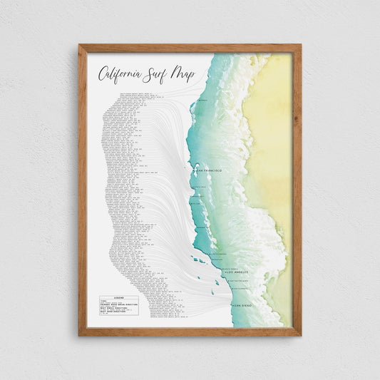
Arizona Trail Map, Your Guide to 50 Epic Hikes in the Grand Canyon State
Share
Arizona is more than just desert and cacti. It's a hiker’s paradise packed with geological wonders, sweeping vistas, red rock canyons, alpine forests, and one of the most awe-inspiring natural features in the world: the Grand Canyon. Whether you're a weekend hiker or a seasoned trekker, Arizona offers an unparalleled variety of trails—each offering its own version of beauty, challenge, and serenity.
With over 50 unique hikes worth exploring and one of the most legendary treks in North America—the Rim to Rim Trail—having a reliable Arizona trail map is your key to unlocking the adventure of a lifetime.
Why Arizona is a Hiker’s Dream
What makes Arizona stand out from other hiking destinations in the U.S.? A few key things:
1. Diverse Terrain
From the saguaro-studded trails of the Sonoran Desert to the cool pines of the Kaibab Plateau, Arizona boasts an elevation range from 70 feet to over 12,000 feet. You can be hiking through a scorching canyon floor in the morning and chilling in a pine forest by afternoon.
2. Year-Round Hiking
Thanks to Arizona’s varied climates, you can find the perfect hike any time of year. Escape the heat with alpine trails in Flagstaff during summer, or explore desert gems like Lost Dutchman and Camelback Mountain during the cooler winter months.
3. Iconic Landscapes
Few places offer the kind of dramatic scenery you’ll find in Arizona: the Grand Canyon, red rock spires of Sedona, the mysterious Wave, and vast deserts that bloom with wildflowers in spring. Every trail is like walking into a postcard.
The Essential Arizona Trail Map, Your Adventure Planning Tool
With so many trail options across Arizona, a high-quality Arizona trail map is a hiker’s best companion. These maps do more than just help you navigate—they inspire you to explore hidden gems, avoid overcrowded trails, and find hikes that match your fitness level and timeframe.
Here’s what a great Arizona trail map includes:
-
Trail difficulty ratings (easy, moderate, strenuous)
-
Elevation profiles
-
Trailhead locations and access points
-
Seasonal recommendations
-
Water sources and rest areas (essential in desert terrain)
-
Scenic viewpoints, campsites, and points of interest
-
GPS-compatible data or mobile access
Whether it’s a physical map you keep in your backpack or a GPS-enabled mobile app, having a reliable trail map turns your hike into a safer, smarter, and more immersive experience.
🏞️ 50 Must-Do Hikes in Arizona
There are hundreds of trails in Arizona, but here’s a snapshot of 50 must-do hikes to help get you started—with something for every skill level:
Northern Arizona
-
Bright Angel Trail (Grand Canyon)
-
South Kaibab Trail (Grand Canyon)
-
North Kaibab Trail (Grand Canyon – North Rim)
-
Ribbon Falls (off North Kaibab Trail)
-
Grandview Trail (Grand Canyon)
-
Havasu Falls Trail (Havasupai – permit required)
-
Horseshoe Bend Trail (Page – short but iconic)
-
Antelope Canyon (Page – guided only)
-
Humphreys Peak (Flagstaff – highest point in AZ)
-
Kachina Trail (Flagstaff – cool forest hike)
-
Lava River Cave (Flagstaff – underground lava tube)
-
Red Mountain Trail (near Flagstaff – hike into a volcanic cinder cone)
-
Bismarck Lake Trail (near Snowbowl – alpine meadows)
Sedona Area
-
Cathedral Rock Trail
-
Devil’s Bridge Trail
-
Bell Rock Loop
-
Bear Mountain Trail
-
Boynton Canyon Trail
-
Doe Mountain Trail
-
Soldier Pass Trail
-
West Fork Oak Creek Trail
-
Fay Canyon Trail
-
Airport Mesa Loop Trail
Phoenix & Central Arizona
-
Camelback Mountain – Echo Canyon Trail
-
Piestewa Peak Summit Trail
-
Tom’s Thumb Trail (Scottsdale)
-
Lost Dutchman – Siphon Draw to Flatiron
-
Treasure Loop Trail (Superstition Mountains)
-
Hieroglyphic Trail (Gold Canyon – petroglyphs!)
-
Peralta Trail to Fremont Saddle
-
Butcher Jones Trail (Saguaro Lake)
-
Wind Cave Trail (Usery Mountain Park)
-
Go John Trail (Cave Creek Regional Park)
Southern Arizona
-
Picacho Peak via Hunter Trail
-
Wasson Peak Trail (Tucson Mountains)
-
Tanque Verde Falls Trail
-
Sabino Canyon – Seven Falls Trail
-
Mt. Wrightson via Old Baldy Trail
-
Ventana Canyon Trail
-
Douglas Spring Trail (Saguaro NP East)
-
Blackett’s Ridge Trail (Tucson)
-
Bear Canyon Loop
-
Cactus Forest Trail (Saguaro NP)
Other Gems in Arizona
-
Fool Hollow Lake Trail (Show Low)
-
Blue Ridge Reservoir Trail (Mogollon Rim)
-
General Crook Trail (Payson area)
-
Tonto Natural Bridge Trail (Pine)
-
West Clear Creek Trail (Camp Verde)
-
Lynx Lake Loop (Prescott)
-
Granite Mountain Trail (Prescott)
...And dozens more in places like Prescott, Payson, Show Low, and the White Mountains. These trails range from short 1-2 mile nature walks to multi-day backpacking treks.
A well-organized Arizona trail map lets you categorize these hikes by region, difficulty, and seasonality—helping you plan a perfect trip no matter when you go.
The Legendary Rim to Rim Trail – A Bucket List Experience
Among all of Arizona’s hiking treasures, the Rim to Rim Trail in Grand Canyon National Park is in a league of its own.
Why It’s So Sought After:
-
It’s a Monumental Feat
Hiking from the North Rim to the South Rim (or vice versa) is around 21-24 miles, depending on the route. You’ll descend over 6,000 feet and climb back up nearly as much. It’s physically demanding but profoundly rewarding. -
Unmatched Scenery
You’ll pass through multiple ecosystems—from alpine forests to red rock canyons to the Colorado River gorge. Few hikes in the world match the variety and grandeur of this one. -
Bragging Rights
Completing a Rim to Rim hike is a badge of honor in the hiking community. It’s not just a trail—it’s a journey through one of the planet’s most iconic natural wonders.
Trail Options:
-
South Kaibab → North Kaibab
A scenic but more exposed route -
Bright Angel → North Kaibab
Offers shade, water stations, and camping options -
Do it in One Day (R2R) or as a Multi-Day Backpacking Trip
Both are epic. One-day hikers need to be in peak condition; backpackers get to take in more of the canyon’s beauty.
Trail Map Pro Tip:
Having a detailed Arizona trail map with contour lines, water sources, campsites, and ranger stations is absolutely critical on this trail. Navigation mistakes can be dangerous in such a remote and intense environment. Topo maps or GPS mapping apps are essential.

Plan Your Arizona Hiking Adventure Today
From red rock cathedrals to high-altitude forests, the best way to explore Arizona’s natural beauty is on foot. And whether you're checking off all 50 top trails or preparing for the Rim to Rim, the smartest thing you can bring is a comprehensive Arizona trail map.
Not only will it guide your steps—it will expand your vision of what’s possible in this breathtaking state.
So, lace up your boots, pack some trail mix, and grab your map. The trail is calling—and Arizona is waiting to show you its magic, one step at a time.


