Sander Maps
Rim to Rim Trail Map Print Hiking Poster
Couldn't load pickup availability
Ships worldwide. US Orders are made and shipped from the US. Delivery typically takes 3-7 days. 21-day hassle-free returns. 18x24.

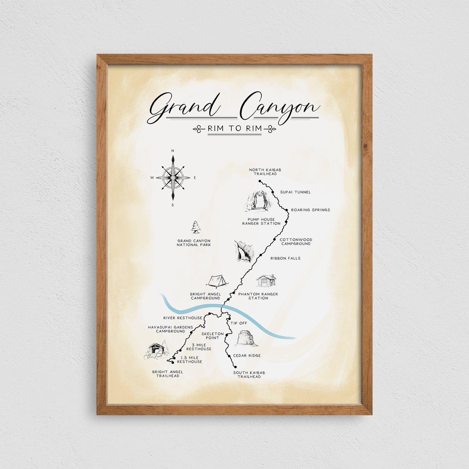
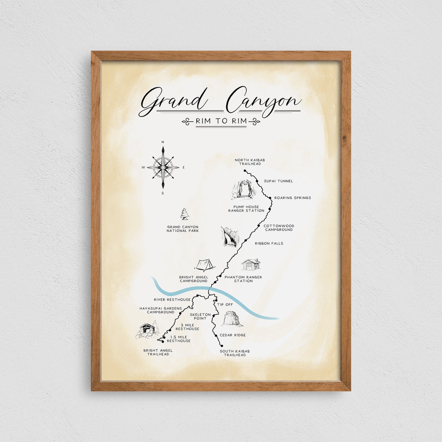
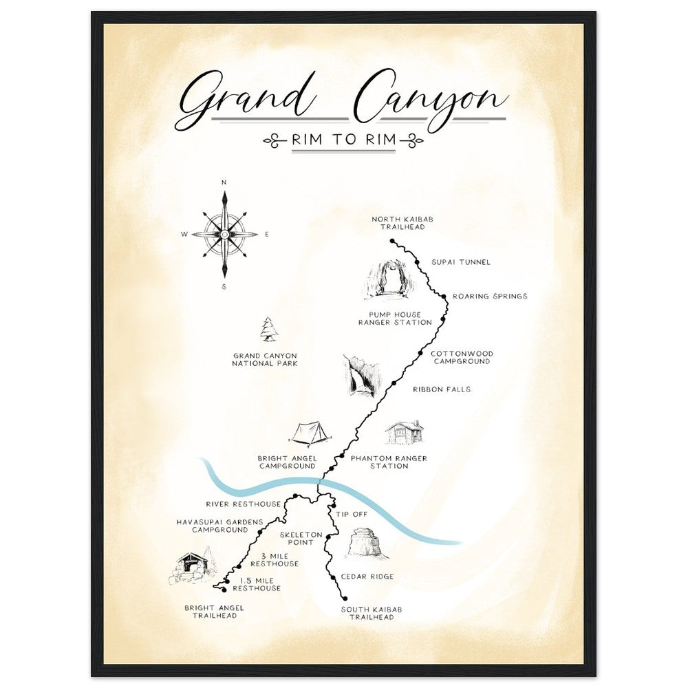
Rim to Rim Trail Map Hiking Poster Print
Our Rim to Rim Grand Canyon trail map highlights key landmarks along the trail with detailed illustrations and names of each significant point.
Each stop on the journey is captured with thoroughly researched details and images to showcase the trail's beauty and history.
Printed on premium matte poster 18x24.
Available with wood hanger or black frame.
Map of the Rim to Rim hiking trail, stretching 21 miles between the North Kaibab and South Kaibab Trailheads, or extending 24 miles from the North Kaibab to Bright Angel Trailhead, crossing the Grand Canyon.
Carbon-Neutral Shipping
Hand-Drawn Map Art
Every Major Rim-to-Rim Stop & Landmark
Eco-Friendly Materials (FSC Certified)
Let customers speak for us
from 25 reviewsGot this as a gift for my surfer nephew and he loved it.
As advertised. Beautiful map and quick shipping.
It was a gift and they thoroughly enjoyed it
The seller made a special effort to expedite processing and shipping as requested.
Perfect gift for my dad who has been several times. He loved it! Brilliant print quality and very detailed.
I have visited Arizona multiple times and really enjoy going to the Grand Canyon. This map is perfect for Grand Canyon enthusiasts, such as myself. The quality of the map is excellent and shipping was fast. Highly recommend!
Ever since I walked the Camino Frances I have been looking for the perfect map. I found it!!
The landmarks are perfectly placed! It is a joy to look at this beautiful map and retrace my journey!
As always, the product was delivered quickly and in perfect shape!